Urban changes in Xinjiang : “sinisation” of the urban space
-
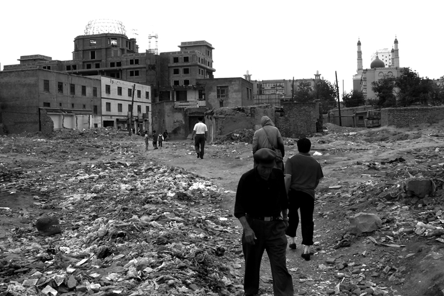
Photo 1: Kashgar, the creation of place with a symbolic column © Jean-Paul Loubes
-
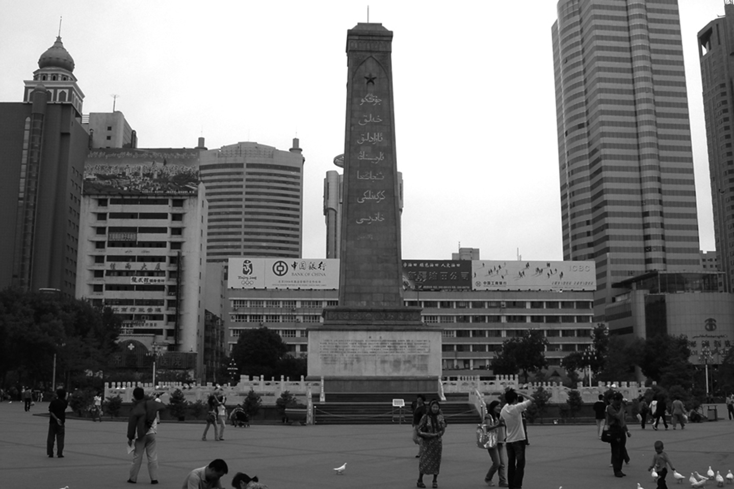
Photo 2: Kashgar, creation of a place with a symbolic column © Jean-Paul Loubes
-
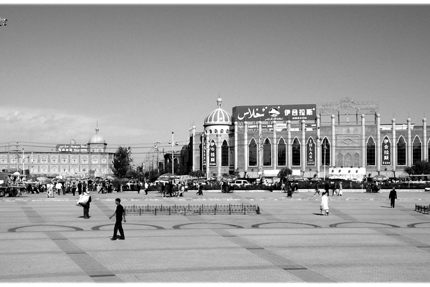
Photo 3: The new place in front of the Aitka Mosque in Kashgar © Jean-Paul Loubes
-
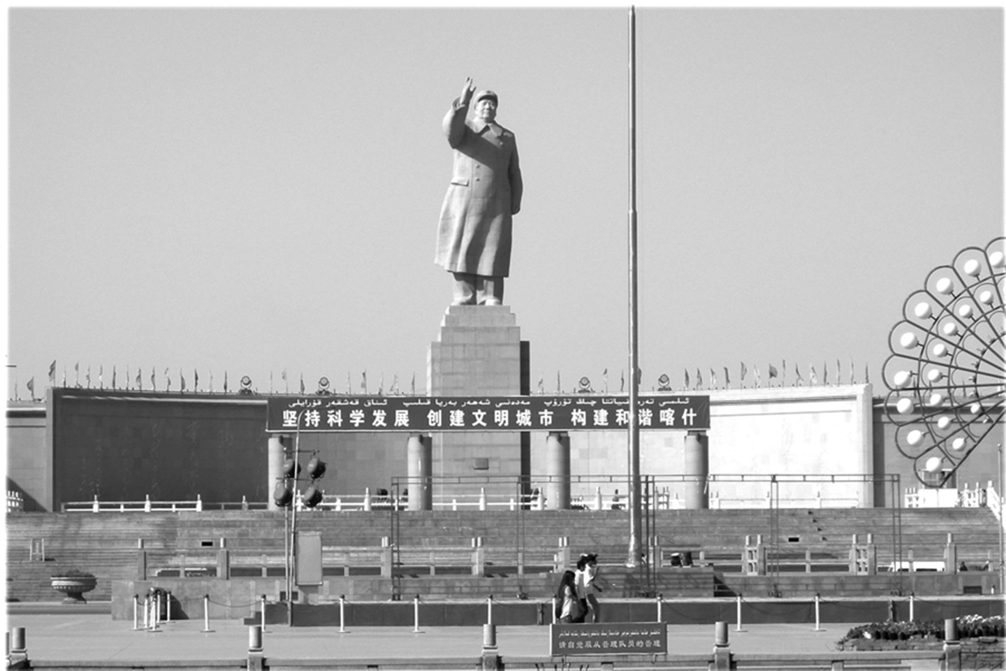
Photo 4: The giant statue of Chairman Mao in Kashgar © Jean-Paul Loubes
-
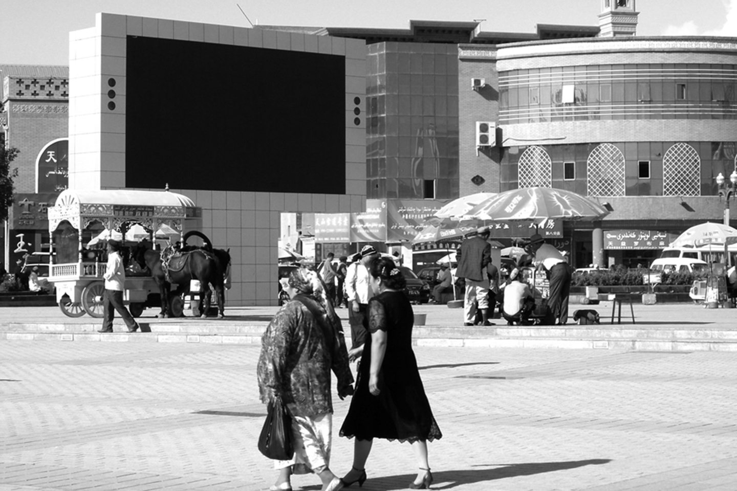
Photo 5: Widescreen © Jean-Paul Loubes
-
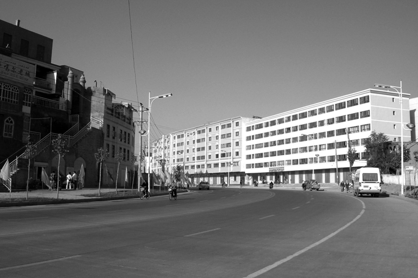
Photo 6: Kashgar, boulevard limit of the Uyghur city © Jean-Paul Loubes
-
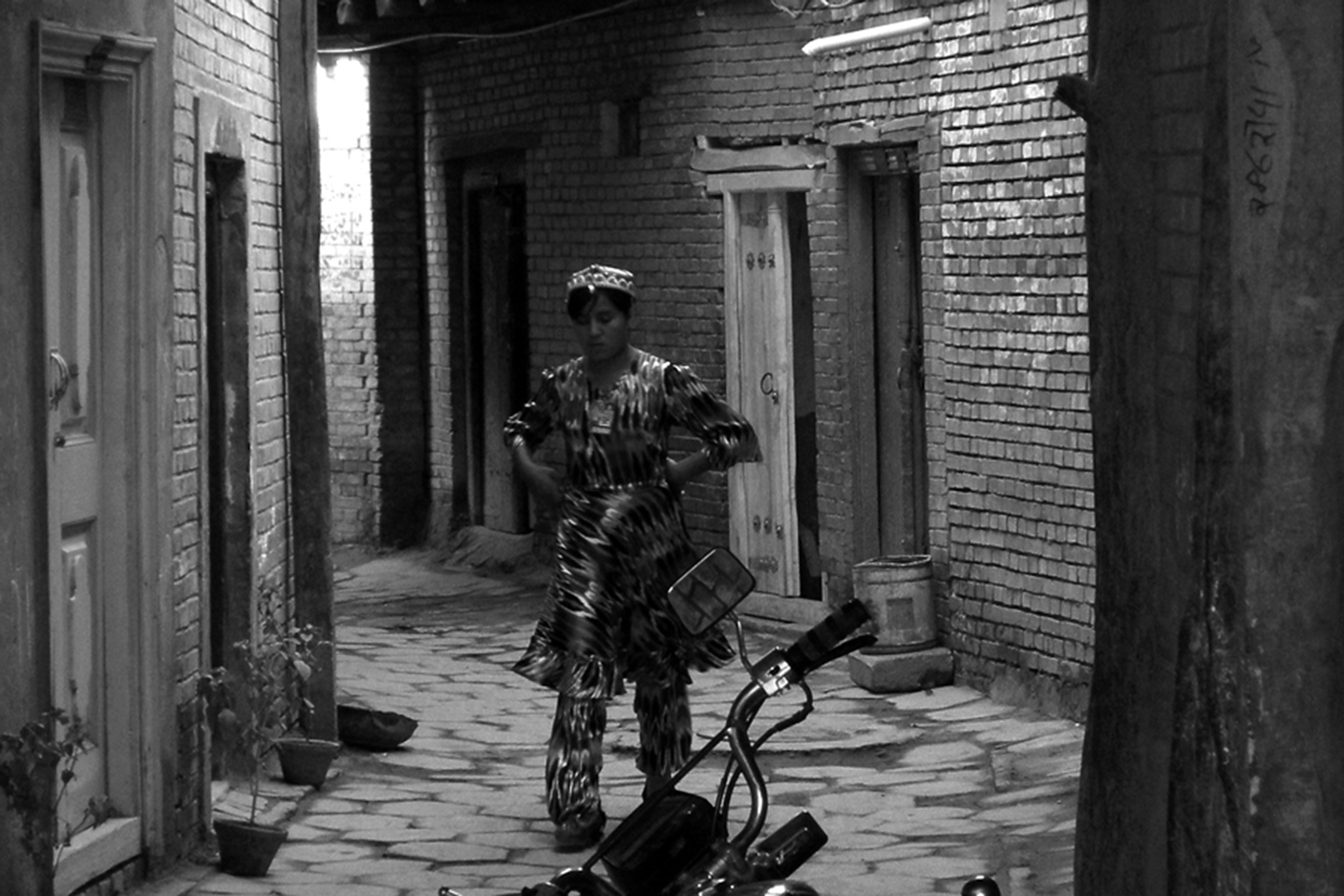
Photo 7: Employment for people from the old Uyghur city as street cleaners © Jean-Paul Loubes
-
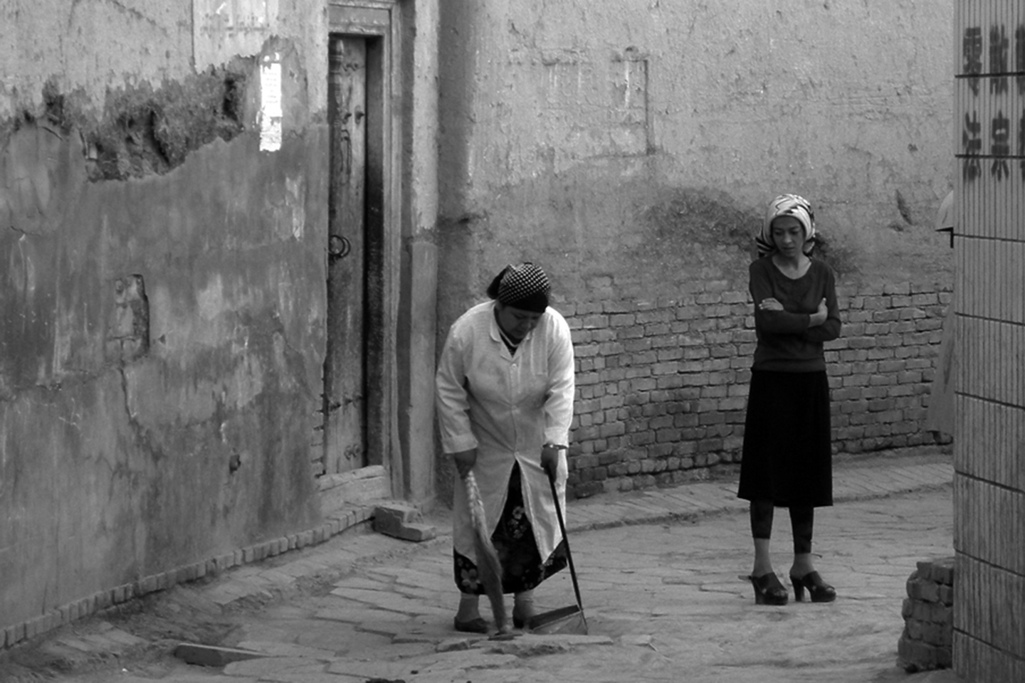
Photo 8: Employment for people from the old Uyghur city in city maintenance © Jean-Paul Loubes
-
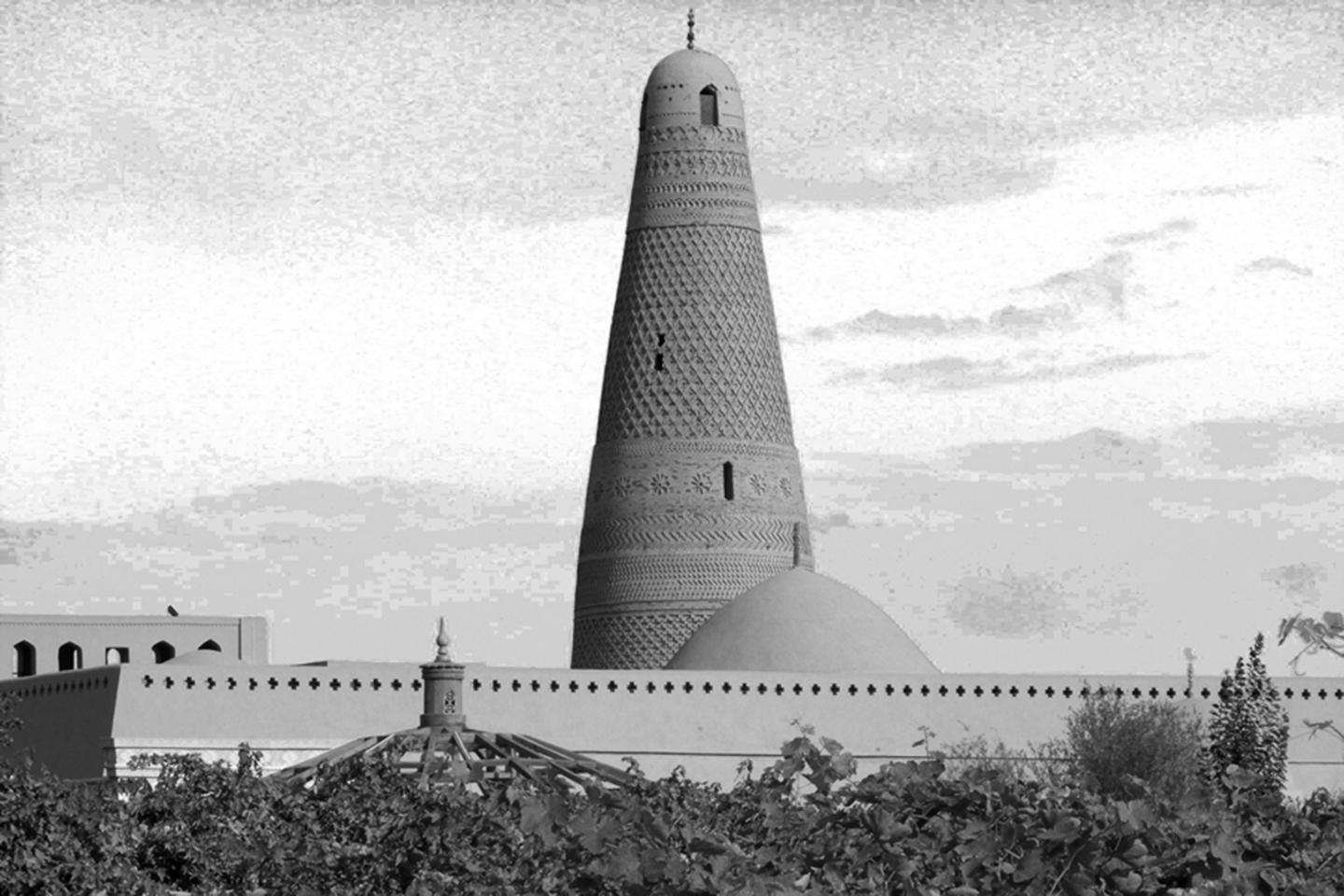
Photo 9: Turfan, Emin Minaret Mosque © Jean-Paul Loubes
-
Photo 10: Mazar of Toyuk © Jean-Paul Loubes
The Chinese model, with its efficiency and power to radically transform urban space, has been operating for approximately 20 years in Xinjiang. As a tool of spatial organization, it has led to the “sinisization” of oasis-cities North and South of the Silk Road, which predominately contain Uyghur populations of Muslim faith. This reorganization of peripheral spaces is an endeavor that began quite a long time ago in cities around China, including in Inner Mongolia (Hohhot[1]) and in dual cities of Xinjiang[2].
The economic development of China over the last 20 years has now lent this transformation an exceptional speed and magnitude. The methods used by developers to create attributes of Chinese space in these territories can be seen as different levels of a calculated urban strategy. The contents of this strategy are articulated around what we have called “Chinese regularity”: the implementation and extensions of new routes in old centers, the creation of central places with their common attributes duplicated in several Chinese cities, and new architectural and urban models. This urban regularity replaces the irregularity which characterized the agglomeration of old settlements, including those of the Uyghur in these oasis towns.
In addition to this renewal of the routes and form of the city, redefining the role of old city centers is a second important factor. China is certainly not the only country to have followed this direction. As was the case in many historic cities of Europe, the “manipulation” of people for tourism radically alters the activity, occupation, and appearance of these centers. Finally, more characteristic of Asian cultures and especially Chinese cultures, is the occupation of visual and sound space in oasis towns by various forms of Han culture, creating a significantly altered urban environment that is alienating to many Uyghurs. The following analysis is based on the cities of Kashgar, Yarkand, Khotan, Turpan and Urumqi, where I have been working and researching since 1990.
Urban transformations in Xinjiang
The strategies implemented to transform Xinjiang’s Uyghur cities are radical. We know that architectural and urban spaces are some of the most complete productions[3] of human culture insofar as, in them lifestyles, representations of the world, and standards of civility are crystallized. It is through these forms that societies often constitute themselves, stabilize, and continue to exist. The change, alteration or transformation of such spaces directly affect the heart of a culture and in turn provoke adaptations, negotiations, or rejections from everday people and inhabitants. There are more than 8 million Uyghurs in Xinjiang. The Uyghur population is tantamount to the entire population of Sweden, or twice the population of Norway or Tibet. Having only recently become a minority in most cities in Xinjiang, they held the position of majority in the province until 1950. At this time, the Han accounted for less than 10% of the population. In the eighties, inner colonization through the acceleration of Chinese population growth caused the Chinese proportion of inhabitants to jump up to 45% (figure from 1988). Today, the process continues with the emigration of low-income Chinese populations, the number now getting close to 50%. In Urumqi, 80% of the population is now Han[4].
Xinjiang, the largest autonomous region in China, covers 1/6 of the country’s total area. The Silk Road bypasses one of the greatest deserts, the Taklamakan, from the North and the South by linking oasis towns that were previously separated by ten or twelve days of travel by caravan. These oasis towns offered much-needed shelter to gradually cross the extremities of the area’s deserts. The distance between these cities gave them a certain autonomy, allowing different people to settle there while retaining their original values: Uyghurs, Tibetans, Kyrgyz, Kazakhs, Russians, and Uzbeks all at one point came to call these cities home. Simultaneously, their location on the Silk Road put them in contact with not only each other, but the outside world, including Chinese, Iranians, those from Central Asia, and Westerners. The number of religions that have been brought into these oasis cities is impressive: Buddhism, Nestorian Christianity, Manichaeism, and Islam to name but a few. In this complex context, original cultures were born that stirred the passions of travellers, explorers and missionaries.
The “Chinese model” as strategy
The traditional model of the Chinese city originated in the ancient Zhou period (12th – 7th century BC), based on principles that were said to come “from the North of China”[5]. These precepts were based on “urban regularity” and have persisted through the centuries in China’s capitals (Xi’an for the Han and Tang, Beijing for the Yuan, Ming and Qing) and spread throughout Asia (Japan, Burma, Korea). The roots of their foundations, as far as we know, come from ancient cosmology[6]. Let’s recall the basic principles that characterize this model: the interlocking of square courtyards, walled cities consisting of a square or rectangular shape, symmetrical grid-cities arranged on a North-South axis, and the positioning of the kings’ or emperors’ palaces on this axis. This model also includes public spaces deployed in straight lines along the avenues, and not on empty urban spaces that are limited by built structures. This also applies to the squares and city-gardens in western cities (which did not appear in China until very recently). The plans of Beijing and Xi’an are illustrations of these principles of urban regularity.
This model represents the ideal of a Chinese city and unifies urban culture across the whole country in the long term. A trove of Chinese values, it is intended to be applied in all human settlements and territories. Yet this model is fairly exclusive in respect to its disregard for mixed Chinese cultures, as Marcel Granet’s work has illustrated. It replaces the culture it encounters without any attempt to adapt or intermingle (as was the case in Mongolia, Tibet, and Xinjiang). Chinese history testifies to this trend. 20th century China has continued in this tradition, with methods that Granet likely could have never imagined when describing his theories of “effectiveness” and “efficiency”.
This radical transformation of urban space involves two levels that form the shape of the city:
1) The urban level: The network of roads and transportation, the templates of voids and solids forming the shape and size of urban islets, and the form of public spaces, streets and squares.
2) The architectural level: Repetitive patterns of contemporary Chinese architecture where functionality and modern design are given priority are replacing traditional Uyghur architecture, which possesses qualities that are significantly more climatically practical, urban, constructive and aesthetic. These traditional Uyghur architectural forms and techniques were developed over long periods of time and performed remarkably in this desert region, one of the hottest places on the planet.
Urban transformations: the case of Turfan[7]
Historical European, Russian and Japanese travelers could conventionally distinguish two urban forms from a distance: the “Turkish city” and the “Chinese city”. A layout plan of Turfan (see scheme map) from the 1970s shows that the two city forms were still distinguishable at that time. The “Turkish” city on the West side (here called the Uyghur city) settled where the karez emerged; the karez being oviducts that collect water from underground (Qanats in Iran).
We can follow the development process as it is implemented from the 1970s. At first, the establishment of regular lines (see scheme map) will link the “Chinese” and “Turkish” neighborhoods, which were quite distinct before 1950. This new urban organization provides the basis for the extension of the current modern city on former agricultural lands today.
Secondly, through the extension of land plots on formerly urbanized parts of the Turkish city, the urban form is reshaped with a new regular cut that replaces the irregularity that previously existed (see scheme map). Gradually, the new network subsumed and replaced the older one. Specifically, it was able to capture and accommodate increasing traffic flow, which became critical after the 1980s. When we consider the importance of busy streets, the activity of free trade that has grown rapidly from 1985, and its relationship with the utility of the car, we can see that the majority of all sales, repair, and restoration activities have been carried out primarily for the benefit of new roads. The swathes cut through the mud houses of traditional neighborhoods are new massive highways spreading “Chinese territory”; rigidly delineated avenues and wide boulevards. These openings are designed to cut standardized islets in the old city. These interventions in the old city spread and proliferated over time, from 1970 to 1990. Proceeding slowly, they could appear as though they were not specifically aimed at traditional residences themselves, but rather at correcting housing alignment and improving traffic flows. An urban layout was being combined with local architecture, whose overall integrity seemed to be generally respected.
The third step is to renovate, one by one, the new delimited islets and substitute Uyghur mudbrick homes for new Chinese collective buildings. The linked figure shows the whole process of the sinisization of space. This applies to other cases of Chinese spatial practice as well, which also include other cultures peripheral to the Middle Kingdom (for e.g. Tibet, Mongolia).
The opening of new linear roads plays a fundamental role in reshaping urban form. It is the new mark of Chinese public space: the wide avenue lined with sidewalks, framed by new high-rise buildings. The new buildings will then border these avenues and mark boundaries, leaving between them some gaps, streets, or lanes, to access the interior of the islets still occupied by Uyghur architecture. The contrast between the Chinese city (the new avenues) to the Uyghur city (the heart of the small islets) is brutal and stark (Photo 1, in Kashgar). The islets resulting from this process will then be renovated one by one from the inside, in order to complete the transformation process of the regularization of the city.
The systematization of a Tiananmen Square-like creation in the center of each oasis-city is the next step. This is the most “visible” of the measures. This place, always of a regular form (square or rectangular), gives the city a new and remodeled centrality around which the values of the Chinese nation can anchor themselves. These values are expressed through the establishment and erection of specific meaningful objects.
For instance, take the monumental column for the “heroes of the revolution.” It is a symbol of unity for Chinese people. The monuments visible in Urumqi (Photo 2) and in oasis cities on the Silk Road’s North and South, such as Kashgar, Hotien, Turfan, or Yarkand, are the equivalent to or replications of the column of the people’s heroes that marks the center of Tiananmen Square in Beijing.
Surrounding the Uyghur city
In Urumqi, the capital of Xinjiang, the headquarters of the Communist Party Committee of the Autonomous Region, along with a few international hotels, overlook the newly renovated urban landscape. It occupies the islet formed by the avenues Jiang Kang, Dong Feng, Zhong Shan and North Heping. Urban surroundings here are comprised of the Bank of China, Hua Xia Bank, and Tian Shan Shopping Center. In 1990, this location was the ancient Uyghur historical center of Urumqi. The adobe houses here were made up of one or two floors, with the ground floor usually occupied by traditional shops.
In Turfan, this kind of urban model is growing on every corner of the North-South axis, in the center of what was once a Uyghur city in 1990. The place is paved with marble and polished granite. With 16mm of rainfall per year, Turfan is the hottest place in China. It requires bold courage to cross this “white-hot plate” in broad daylight at midday. The ponds and fountains that retain water from the melting snowy caps of Tian Shan Mountain appear as an outright challenge when water is scarce in Taklamakan and when ice disappears from the mountain top. Public gardens are made with plastic imitations of palm trees and cacti that resemble the vegetation of Arizona.
In Kashgar, the huge marble square that contains a giant statue of Chairman Mao at its center (Photo 3) presents the same axial character of his preferred urban mode of organization. This construction has not only transformed the urban form of Kashgar, but has disqualified another space that was a significant emblem of Uyghur culture: the large space in front of the famous Aitka Mosque. Previously located in the heart of the city, a bustling core with leather craftsmen, string instrument makers, booksellers and religious text vendors, the nucleus of the city has now been completely remodeled and the area surrounding the Mosque destroyed and rebuilt (Photo 4). The streets crowded with merchants have given way to an area that seems oddly out-of-scale. The Mosque is now a small, insignificant structure on the edge of a huge space that has been redeveloped with new commercial buildings. The monument has lost its meaning in the city.
And then there is the digital widescreen: a repetitive device, both marker and propagator of messages about Han culture. Within newly developed places, the remodeling of physical space has been has been completed with the creation of a new visual space and soundscape (Photo 5). Every evening, announcements of Chinese modernity are broadcast into this public place. These messages include everything from publicizing Chinese films to broadcasting the Long March’s épopé. In Kashgar, Urumqi, Turpan, and Hotien, the same device has been installed. The device’s occupation of public space leaves little room for the original urban culture of the sites.
In Kashgar, in the eyes of the Chinese urban planner, it seemed impossible to completely erase the old city. An important religious center of Sunni Islam, and also the center of the Sufi brotherhoods, a complete upheaval of the existing urban fabric would have likely solicited opposing acts of resistance in the major Uyghur cities. However, the need to contain the extension of the “indigenous” city was accomplished by opening a new path beyond which the Chinese city could develop. In Kashgar, this was done with the construction of the new Tuman Avenue, running along the north wall and blocking any extension of the Uyghur city with a bordering wall of new Chinese buildings (Photo 6).
Transformation of the old city centers. Since 2007, access of foreigners to the old town (Uyghur city) has been heavily restricted. You can enter only after having purchased a ticket from one of the four authorized departments established for this very purpose. As the city does not have an enclosure, young Uyghur girls are responsible for monitoring visitors’ tickets (Photo 7). A document given to the tourists reveals what is described as an “attraction”: “By visiting the Old Town you feel like you are in the Middle Ages. Here you can observe typical Uyghur folk customs…handicrafts such as carpet-making…You can visit a Uyghur family in their characteristic traditional home and sample traditional Uyghur food and culture. The colorful entertainment will offer you a lot of fun and give you a feeling of the mystery of the old town”. The writing on the entrance ticket reproduces some lyrics praising the delights of Xinjiang and Kashgar, borrowed from the “famous Chinese poet Guo Xiaochuan”.
Finally, in order to be presentable to foreign and Chinese tourists, this “Uyghur town” must be kept in a remarkable state of cleanliness. Older Uyghur women are employed to clean the streets during the daytime (Photo 8). Their clothes are the only touch of color that the groups of amused Chinese tourists and amateur photographers will see as typical and traditional activities of the eastern city have all been wiped out (bazaars, crafts, the historical neighborhood of booksellers and religious book vendors, a popular tourist destination in the past).
Burying History
Along with the urban transformation underway in Xinjiang cities, the adaptation of historical sites to conform to successful models of development in the tourist industry consumes a large amount of planning resources. This global phenomenon obviously extends well beyond the case of China. Here, like elsewhere, there is a corollary of the development of urban societies craving a story, narrative, or anchoring identity. The desire of urban modern societies for “Heritage” is the manifestation of this demand[8]. The following two examples support and complement the restructuring of Turfan as mentioned above.
Religious or civil Uyghur architecture, which remains a visible heritage of modern Xinjiang, presents an architectural form linked to Islam. Construction projects geared towards tourism in Xinjiang consist of superimposing “Chinese” architectural pastiches to the existing Islamic built environment.
The Imin Mosque in Turfan and its unique minaret: a “new story”. This architectural site was among the cotton fields east of the oasis, somewhat removed from the urban area (Photo 9). The new edifice built near the Imin Mosque is a masterful example of disfigurement and falsification. A sign for tourists says “Ancient Prefectural Residence Turpan”. However, the construction of this magnificent new building here is not based on archaeological research. With its color, form, and the care taken in its construction, this false building now rivals the Imin Mosque, which was recently “restored” (i.e. completely rebuilt). Thus, one of the most prestigious architectural monuments in Xinjiang is tragically severed from its interaction and conversation with its surrounding urban environment by a contemporary structure erected in 2003: “French” ponds in the desert, exotic plantations with “urban gardens”, concrete statues for fanciful pageants where tourists can take photographs, a big shopping area and a glazed car park for tourist buses.
Finally, the mosque is presented within a circular area, the combined result of excavations and a total remodeling of the site, with its symmetry set in accordance with ideals of “Chinese territory”. This cacophony, led by the famous Prefectural Residence, and the new development of the mosque, is a misuse of the history of this rich site; yet no visitor will be able to recognize this fraud. This place was once a representation of Uyghur architectural culture, but now, as a consequence of its remodeling, it has lost this important original value. The formerly prestigious mosque has been relegated to a small role in the fictitious scenography to warp and then correct the history of the place. The new building replaces Uyghur reality with a Chinese past on a formerly significant religious site. Other large-scale “improvement” projects are also underway on important archaeology sites at the Kizil caves, as well as at the necropolis of Astana. The site has been covered by other elements (concrete statues) and it culminates in the famous and beautiful caves and temple of Bézéklick. Just as Islam arrived and established its foundational bases on many sacred Buddhist sites, “something” is now colonizing, co-opting, and paving over the remains of original Uyghur culture. How can this “something” be described?
The site of Mazar of Toyuk (Photo 10). This village is about 30 kilometers from Turfan. Excluded from the tourist circuits until the early 2000s, a new road in the desert now provides guided tours access to this religious site. The recent rebuilding of this holy site for Muslims by the Chinese authorities is yet another example of the burying of original historic places by a contrived and fictitious history.
Editing of publications for the use of visitors. In recent years, many tourist books have been published and distributed on Buddhist Turkestan. They popularize the archaeological discoveries on the North and South roads, as well as the works and photographs of explorers who, in the late 19th and early 20th centuries, uncovered the rich history of Buddhism in the region (e.g. Regel, Grünwedel, Le Coq, Otani, Tachibana, Koichiro, Pelliot, Stein, Sven Hedin, etc.)[9] . It should be noted here that these “treasure hunters” have paid no attention to the historical evidence of Islamic architecture and heritage, even as they sought Buddhist relics in an Islamic land. In this light, we can understand how their research has now become quite valuable to the Chinese. The travels of Xuanzang, the famous Buddhist monk who left for India and brought back to China several infamous Buddhist sutras, has been continually updated, elaborated on, and publicized over the years. Descriptions of Buddhist sites are frequently relayed in his stories while any mention of Islamic traces is omitted. These methods contribute to the loss of Xinjiang’s Islamic heritage as amendments, adjustments and elisions are made in the name of promoting its Buddhist past to bolster tourism.
The recent decision of the Chinese government to make Kashgar the “Shenzhen of the West” by conferring on it the status of a Special Economic Zone will accelerate the completion of the spatial transformation described above. The remains of indigenous urban forms that previously existed in the oasis towns will likely be unable to resist the needs of these economic and commercial projects. In Hotien, Yarkand, and Turfan, a great architectural and urban culture is likely to disappear in silence in the face of global indifference—especially on the part of the architectural community—to its plight under Chinese modernity.
Notes
[1] Piper Rae Gaubatz, Beyond the Great Wall, Stanford University press, 1996.p 62.
[2] Jean-Paul Loubes, Architecture et urbanisme de Turfan, L’Harmattan, 1998.
[3] Amos Rapoport, Anthropologie de la maison, Dunod, 1961.
[4] About the Uighur origin and the origin of the ethnonym, see in : Cahiers du C.E.M.O.T.I N°25, 1998. Les Ouïgours au vingtième siècle, the articles of Françoise Aubin, Dru C.Gladney, Michel Jan, ArtoushKumul.
[5] The Kaogongji (part of the ritual of the Zhou minority) prescribed a mode of creation of the capital based on cosmological references implementing a regular geometry (axiality and a perfect square). Even if all cities do not meet these provisions, including topographical obstacles, this mode of creation, however, had a model value in terms of the capital’s establishment and the new implementation of cities.
[6] Paul Wheatley, The Pivot of the Four Quarters, Edinburgh University Press, 1971
[7] Jean-Paul Loubes, 1998 op cit.
[8] Françoise Choay, Le patrimoine en question, Seuil, 2009.
[9] Quotes: Shi Xiaoqi, « Footprints of foreign Explorers on the Silk Road », China Intercontinental Press, 2005.
[10] Peter Hopkirk, Bouddhas et rôdeurs sur la route de la soie, Arthaud, 1981.
-
2015/03/16

-
Xinjiang

-
Jean-Paul Loubes

tags


A Step Further
more
the other map
Exploreloading map - please wait...
